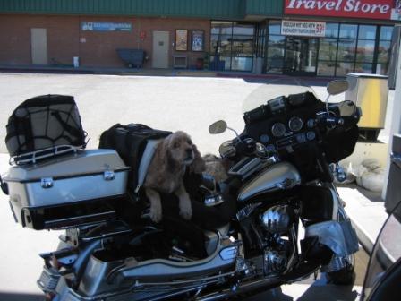

pic 1: who says you can't take the dog?
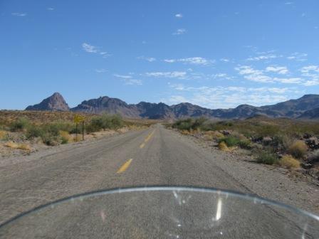
pic 2: hwy 66 as it runs into mountains
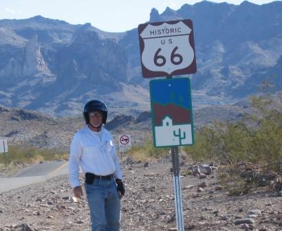
pic 3: wow! the timer on the camera works!
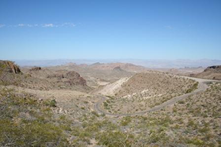
pic 4: twisty turn hwy 66 looking down on its curves.
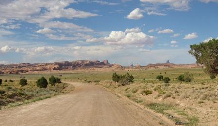
pic 5: beginning of Monument Valley
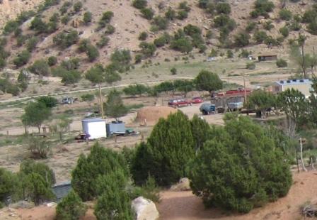
pic 6: typical out of town, Native American living place...almost all residences have a mud "sweat lodge"...see the brown, dome-shaped structure.
Day 20 August 21 Monday - 385 miles
Historic Hwy 66 – I almost didn’t get to ride it.
I woke up and packed the Harley at 8 in the morning, and the parking lot was already beginning to feel like an oven. By 9, when I left, it was over 90 and within the next 30 min it hit 100. So, the leathers stayed on the back of the Harley.
Rt. 66 was running near I-40, and a quick look at the map showed there were a couple of good options for a ride on it, but I have to admit that I was surprised by the outcome.
We ran east for a little on 40, then turned north on 66 at Topock. Within a few miles I came into Golden Shores, which is little more than a few trailer houses, VFW lodge, and ratty convenience stores. At the VFW, a man starts to move across the parking lot toward the road I’m on. I slow a little, he looks RIGHT AT ME (the sun is in his back, highlighting me, mind you), and pulls out in front of me. I swerve to the other lane, thank god no cars were coming, jump on the horn, and miss him by quite a bit, but it could have been a very bad moment. What’s with that? He doesn’t see me! And I’m running three headlights! Jeez!
Hwy 66 is rough, no shoulder, but you can just sense the old cars moving up and down it, passengers leaning over buckets of ice to try and stay cool, cars overheating, and drivers praying they don’t break down. The thing is, if you wait for cool weather, the rain runs down the washes, potentially stranding motorists. If you go when hot, you face 100+ days. And then the road got really funky.
Up ahead, the looming craggy mountains loomed and the map showed that I would come up on Oatman. What the heck was Oatman I wondered? It is an old mining town that is still inhabited, almost completely as a tourist stop. The buildings are made from the vertical slats of wood, cedar I think, and corrugated metal. It was established in 1908 and over a million ounces of gold was mined. It eventually closed down, excepting for a few federal mines still nearby. I’m just amazed at how HARDY people were who lived in inhospitable places without a/c, McDonalds, or all the other conveniences we take for granted.
After Oatman, Hwy 66 went nuts…it would up, down, around, reminding me of the old PeeWee Herman show where the road sign turn warnings wound into a knot. In fact, Hwy 66, the whole time I was on it, impressed me with how its builders cooperated with the land rather than try to dominate it. Sadly, many drivers apparently did not do the same as the sharp, steep curves into the gulleys and washes were often marked with crosses.
But, I came down eventually and hit I-40. I wanted to ride another 70 miles of 66, but figured I would have plenty of good riding ahead on other roads. On this point, I think I was correct.
The road climbed into Flagstaff, eventually reaching 7400 ft and the temperature dropped accordingly, although it never got lower than 80. The road to Flagstaff was very much like you would see in Southern CO or some places in New Mexico. Cedars were plentiful and healthy, and there were more than a few signs warning of elk on the highway.
In Flagstaff I headed north on Hwy 89. Hwy 89 was interesting in that the landscape just totally opened up. For the last two days I had been riding desert hemmed in by mountains, but now the whole northern vista dropped away in a wide plain, with the mountains way out on the horizon.
Eventually, I ran along the west edge of the Painted Desert. Yes, it layered with red, white, and mauve.
From 89 I turned northeast on 160, figuring I would stay in either Tuba City or Kayenta, both of which were in the Navajo Indian Reservation.
Tuba City was not very impressive, to say the least, so I continued toward Kayenta…and I’m glad I did.
On the way to Kayenta, I began to run through eroded canyons and skirt weathered mini-mountains. It began to look like Utah, Moab in particular, in places. Little wonder, because I was approaching the border with Utah.
Kayenta is an Indian reservation town. Stray dogs, hungry, thin, some nursing mothers, roam everywhere. Some sections of the town are what you might call “typical reservation” while others are very new and clean. No alcohol can be sold or served anywhere on the reservation.
Tomorrow I’ll get up early to catch the morning light on the buttes.
Low point of the day: It being so hot so early.
High point of the day: 1st runner up is Hwy 66, but the real best note of the day was the phone call from my son, informing me how well his audition went for a small role on Veronica Mars. Later, he called me again and told me that he already had gotten the notice for a callback tomorrow. Whoo hoo!


1 comment:
Your journal entries and pics are too good to miss - the kids look great! Don't get fried in the heat. Watch the road and come back in one long, lean piece. Oh, and congratulations on being a grandfather -- again.
in fun
Post a Comment